Street-level imagery and map data, faster than ever.
Starting @ $10,000

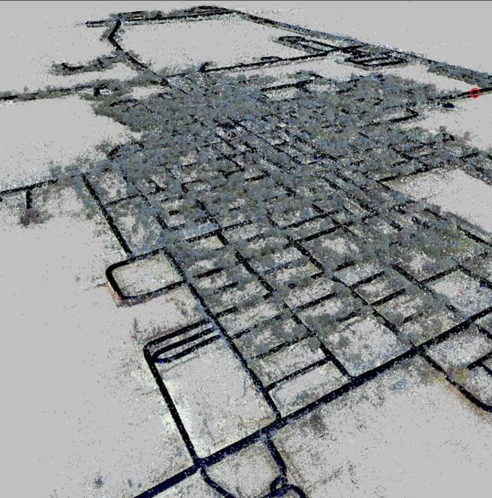
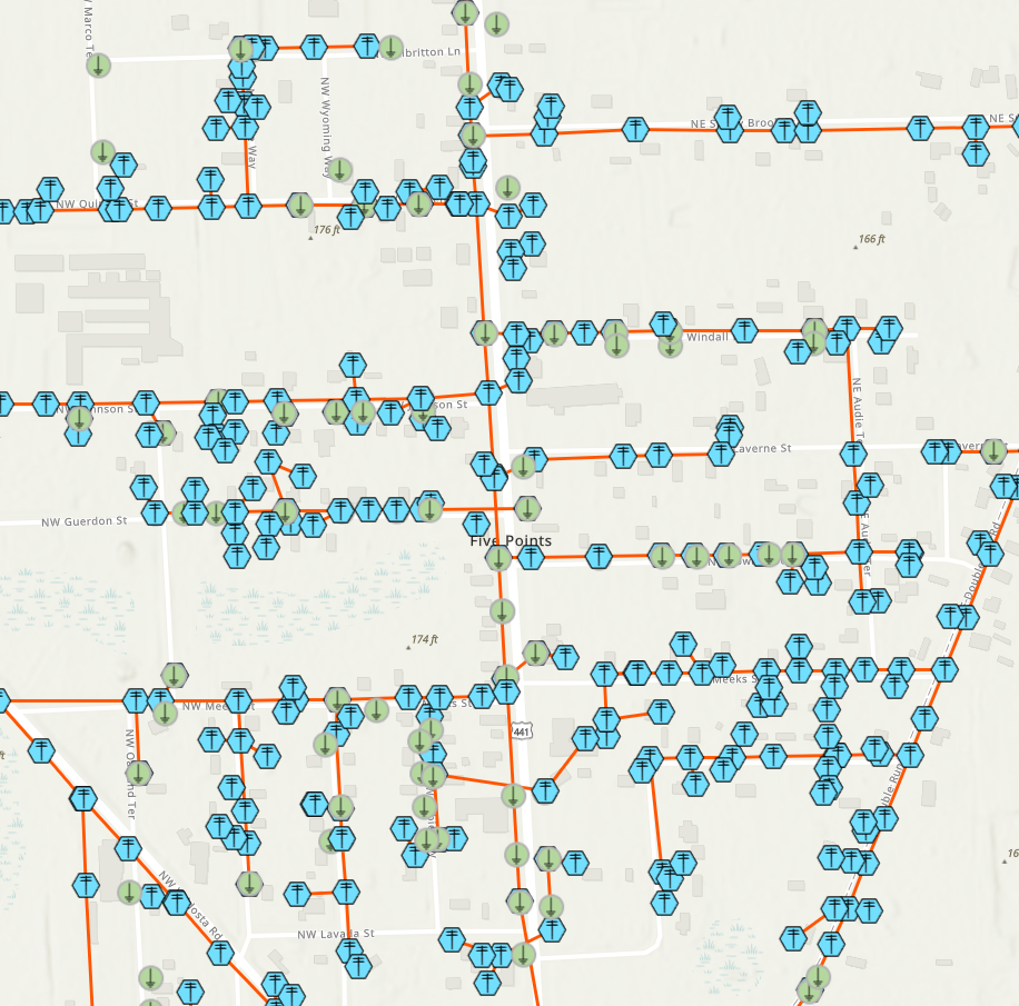
Utility Poles, Devices and Connectivity

Map Road Assets and Conditions
Super simple, we drive your Area of Interest (AOI) using our GeoCam 360 cameras.
Our team uploads and manages the processing through our Visual Positioning Engine.
You get access to the GeoCam SaaS to view imagery linked with your existing web maps.
Task us to map objects - select one of our pre defined data models or provide us yours.
10cm accuracy 2D XY. It’s never been easier.
GeoCam Workflow
Capture, Process, View & Map

GeoCam 360 Camera
High Accuracy GNSS
Machine Learning Engine
36 MP 360 Imagery
2m Interval at Freeway Speeds
GeoCam Visual Positioning Engine
Unlimited Scale Imagery
Multi Pass Matching and Alignment
Object Segmentation and Detection
Enables Mapping and Measurement

GeoCam Online
View and Navigate Imagery
Share Views via Dynamic URLs
Leverage Esri ArcGIS Web Maps
Create New Map Objects
Annual Subscription starting at $10,000
SaaS + Data Hosting
Included 1 Admin + 5 Viewers
Hosting included
Add Additional Users Per Year
Viewer $120
Editor $1,000
Street-level Imagery Capture and Processing
Included 50 Miles Street Centerline
Data Capture and Processing
Privacy First (Face and Number Plate Blurring)
PII runs in the GeoCam 360 camera and on the server
Included with no additional charge
Map Data Production
Included 500 point features
Pick one of our data models
Add Additional Data Blocks
$500 per 1000 features
Volume Discounts
Need more than 50 miles?
Add more miles per year or Lock in multi-year repeat captures
| Annual Commitment | <250 miles | 251-1000 miles | 1001-5000 miles | >5000 miles |
|---|---|---|---|---|
| 1 Year | $70 | $62 | $50 | $45 |
| 2 Year | $58 | $50 | $42 | $35 |
| 3 Year | $45 | $38 | $32 | $25 |
Geospatial Data Models, powered by AI.
Need help creating large scale map data? Our services team can generate a range of pre-defined data models using our state of the art computer vision models. We can fine tune our models to meet your specific needs.

Public Works Assets - Signs by Type, Poles, Signals, Streetlights, Storm Water. Esri Local Government Data Model.
Telecom Fiber Network Assets - Poles, Attachments, Connectivity, Cabinets, Access Points, and more.

Electric Distribution Network Assets - Structures, Devices, Structure Junctions, Electric Line and Sub Networks


BYO ArcGIS Online
Seamless integration into the GeoCam Viewer
Built with the ArcGIS JavaScript API and associated tools. Search, Measure, and Map GIS features. Each GeoCam User connects to an ArcGIS User.
Work with Private, Secure Web Maps
Register your Web Maps with the GeoCam Portal and provide access to users across your organization with high quality imagery to go with their map layers.
Leverage ArcGIS Solutions and Data Models
Create your own 2D using GeoCam Imagery as a reference. Map all sorts of features along the road right of way.
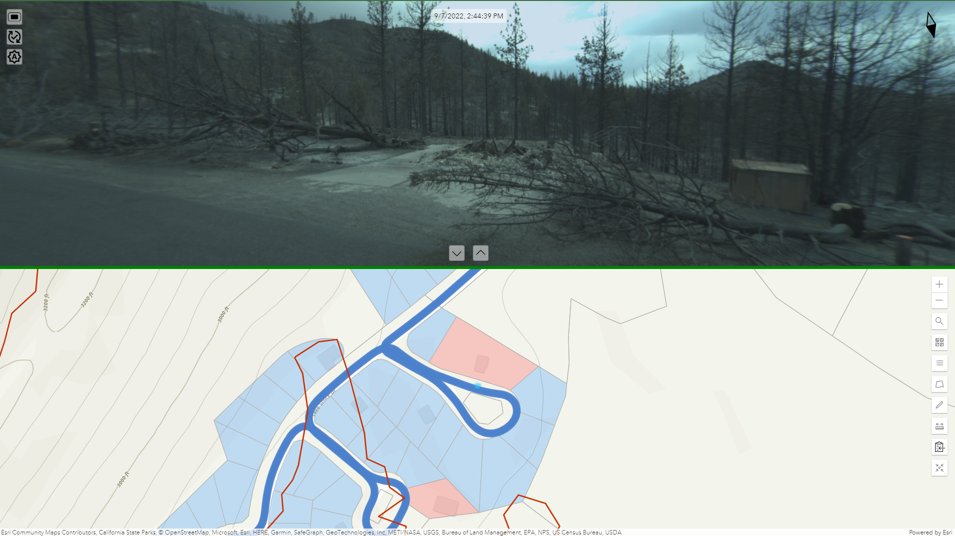
Disaster Response - A Single Source of Truth
We offer a service delivering safe, reliable imagery and damage assessments inside of evacuation zones. Chat with us to learn more.
Upcoming Events
-
Esri Partner and Developer Conference
March 10th to 14th, Palm Springs, CA
Live Demo
Come chat with us on use cases for large sale, rapid imagery collections. We’ll be discussing how Esri partners and developers can work with GeoCam.
-
DISTRIBUTECH 2024
Feb 26-29th, Orlando, FL
704B - Startup Pavilion Space
We’ll be announcing a new capability at DISTRIBUTECH. Come check out the future of ML and Geospatial Imagery for Utilities.
-
Esri User Conference 2024
July 14-19th, San Diego, CA
Find us in the expo at the grandaddy GIS event of them all. Watch this space, we’ll be featuring a new release for the conference. Not all views are created equal …