GeoCam and UCLA Transforms Campus Accessibility Mapping with Data
In early 2025, UCLA partnered with GeoCam to capture and modernize its pedestrian infrastructure data. The goal was ambitious but clear: to produce a high-accuracy, imagery-backed digital map of every sidewalk, pathway, ramp, and ADA-related feature on UCLA’s 419 acre campus.
The Challenge
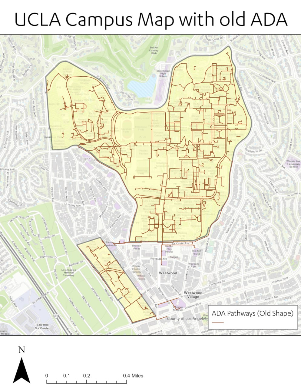
With decades of campus evolution and ongoing construction, UCLA needed verified, measurable data to support accessibility audits, facilities management, and event planning, which would improve UCLA’s ability to plan for and support significant events like LA28. The existing sidewalk data /map they had provided very limited value: it had centerline data only, did not include surface types, vertical features (i.e. stairs, ramps, etc.), actual widths, or slopes.
As a result, UCLA’s Mobility Planning & Traffic Systems team was encountering difficulties as they worked to coordinate construction, assess accessibility, and optimize routes for visitors, especially those needing accessible routes. A modern, comprehensive, and easily updatable dataset was required; they needed a data solution that could capture complex pedestrian environments while being verifiable and visually auditable.
The Approach
GeoCam’s solution offered a unique combination of speed, accuracy, and visual context. By leveraging 360° imaging, precise GNSS positioning, and automated processing, the team at UCLA would be able to capture rich, semantically classified GIS data far faster than traditional survey methods.
The project unfolded in three main phases: capture, processing, and data production and QA.
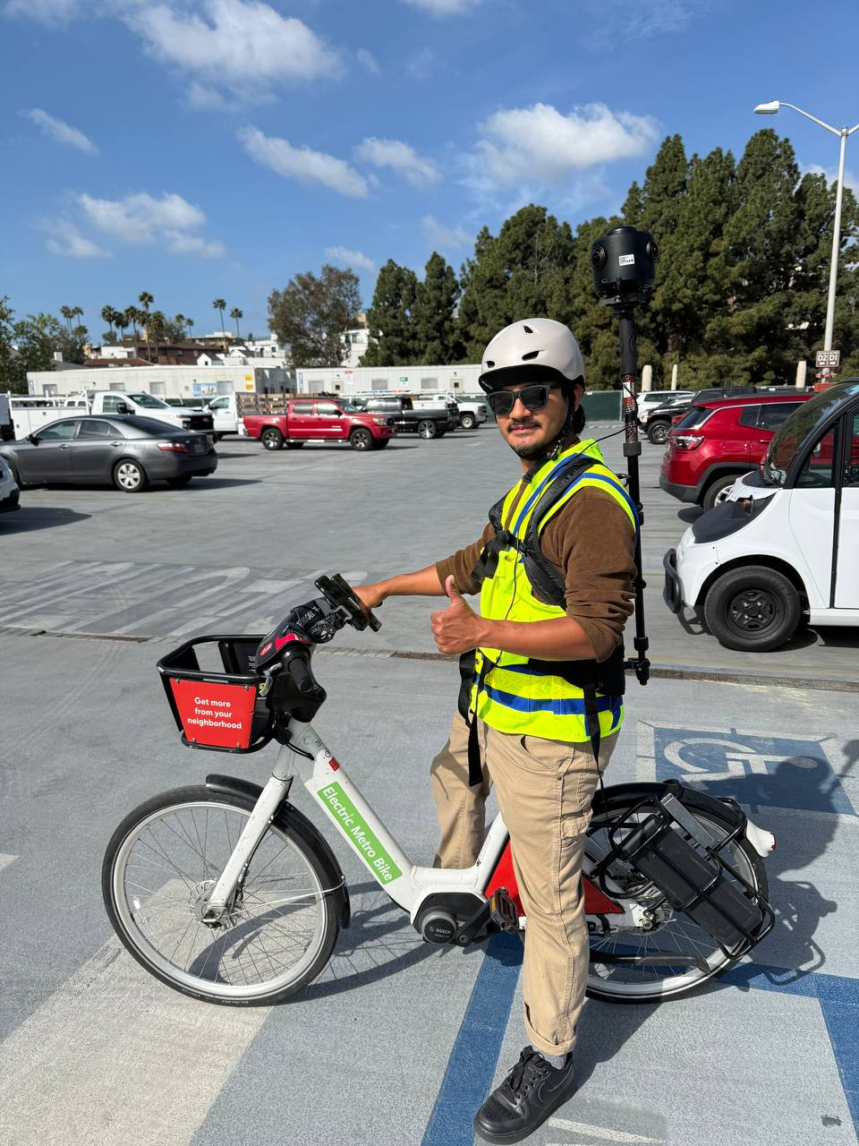
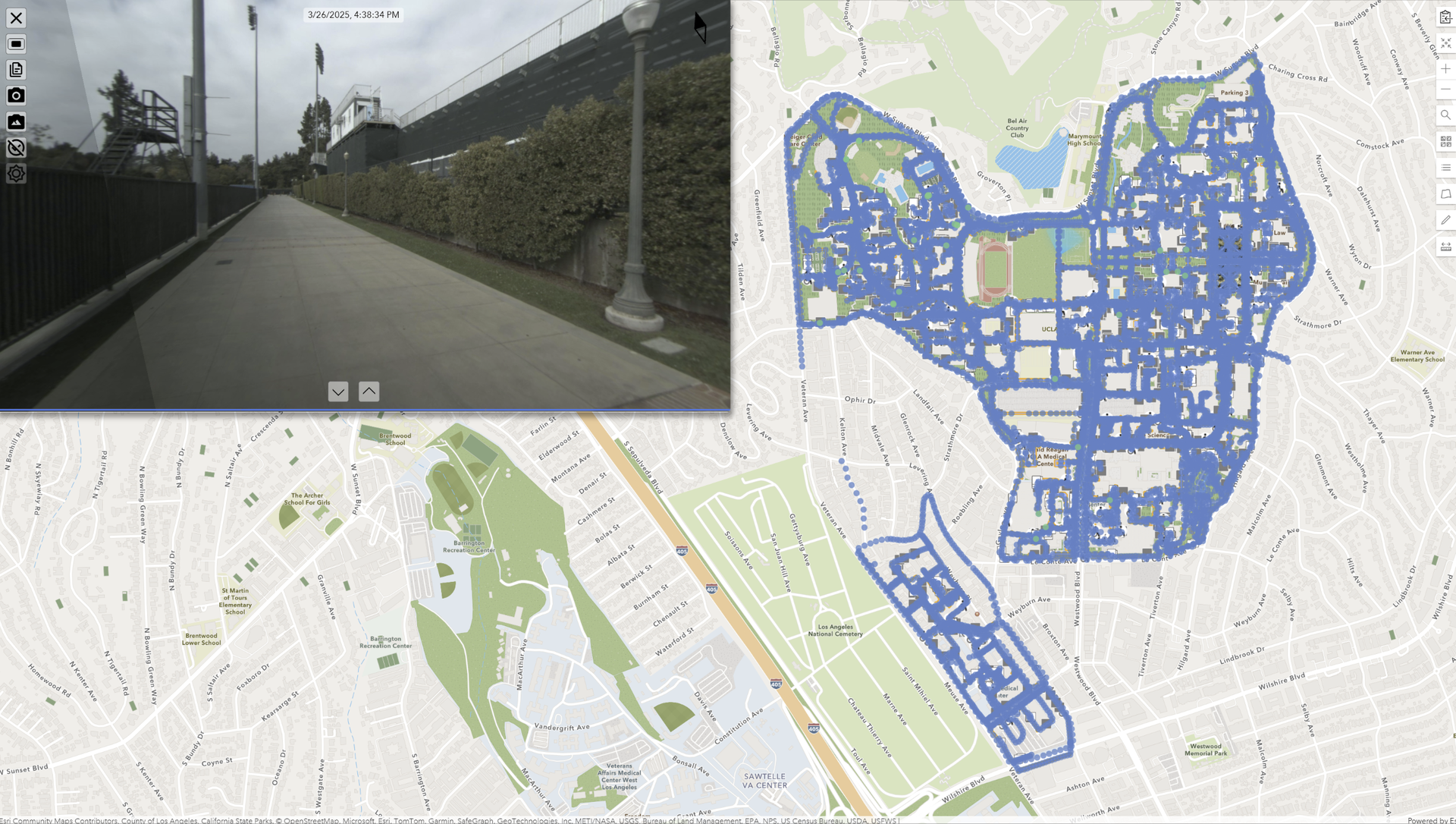
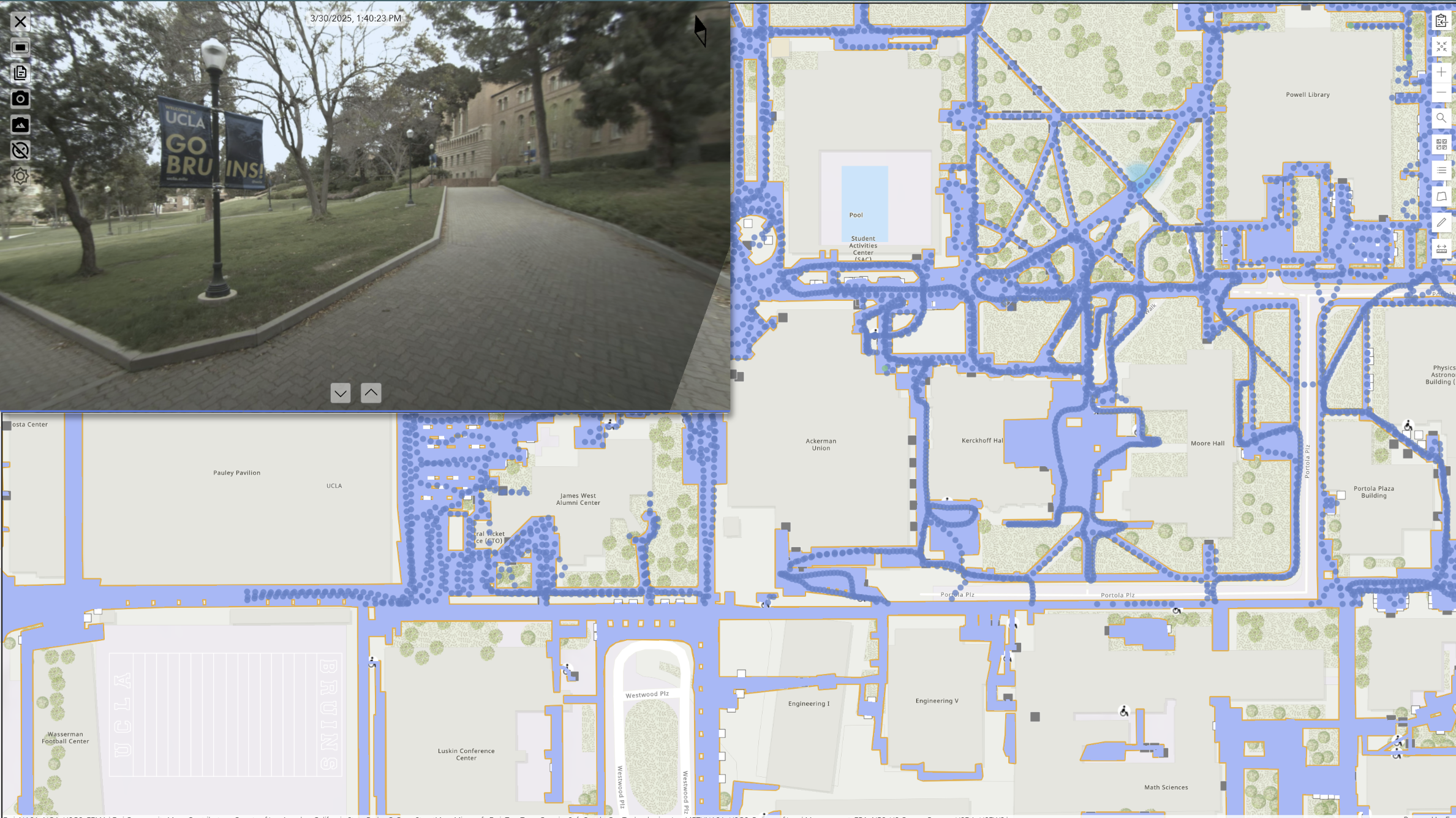
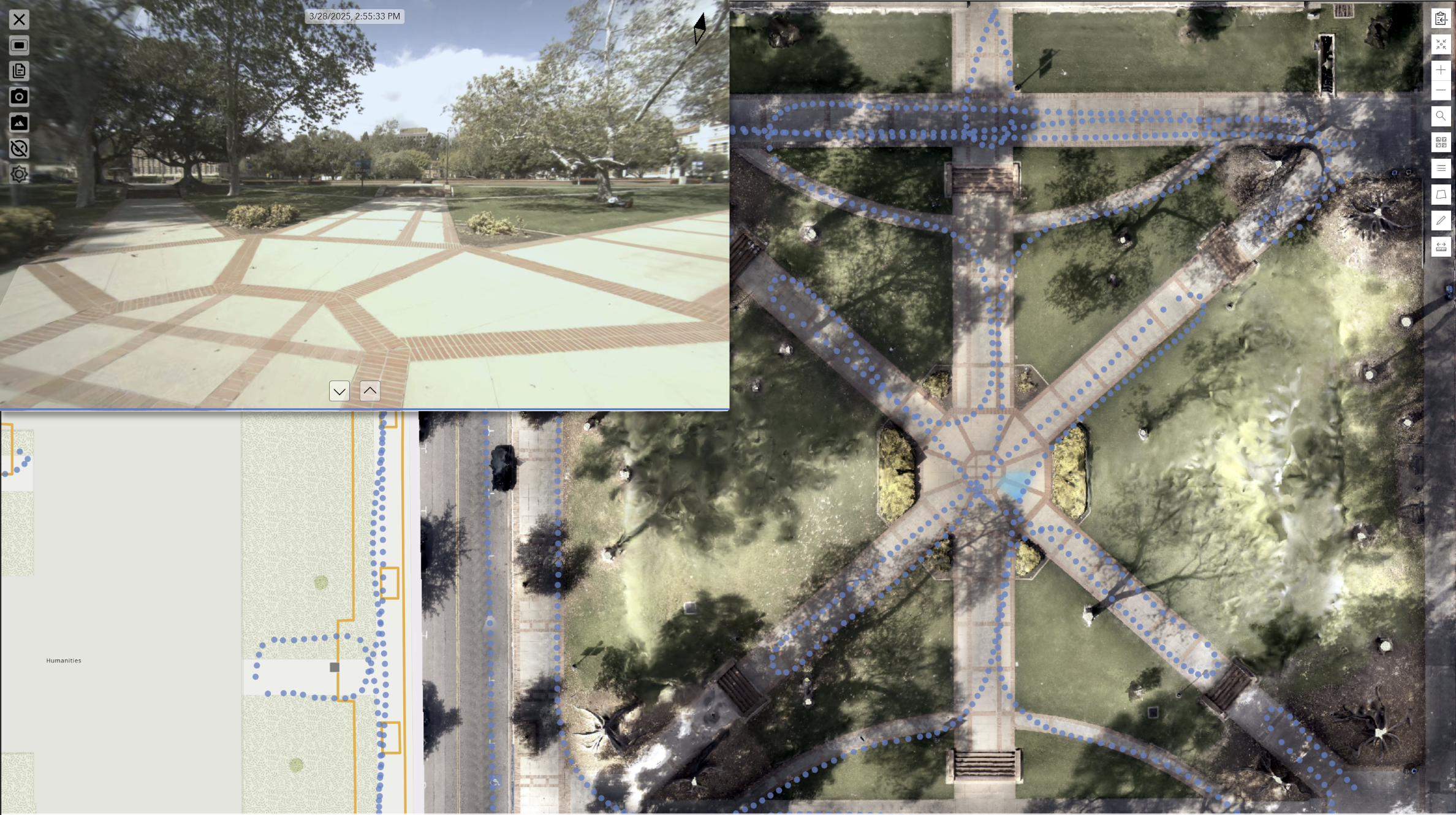
Capture: Over two weeks in March and April 2025, GeoCam’s team imaged approximately 42 miles of sidewalks, plazas, and pathways. Using a combination of walking, e-bikes, e-scooters, and driving cars; equipped with the GeoCam 360° high-accuracy cameras, the team logged high-resolution imagery, GNSS positions, and camera metadata.
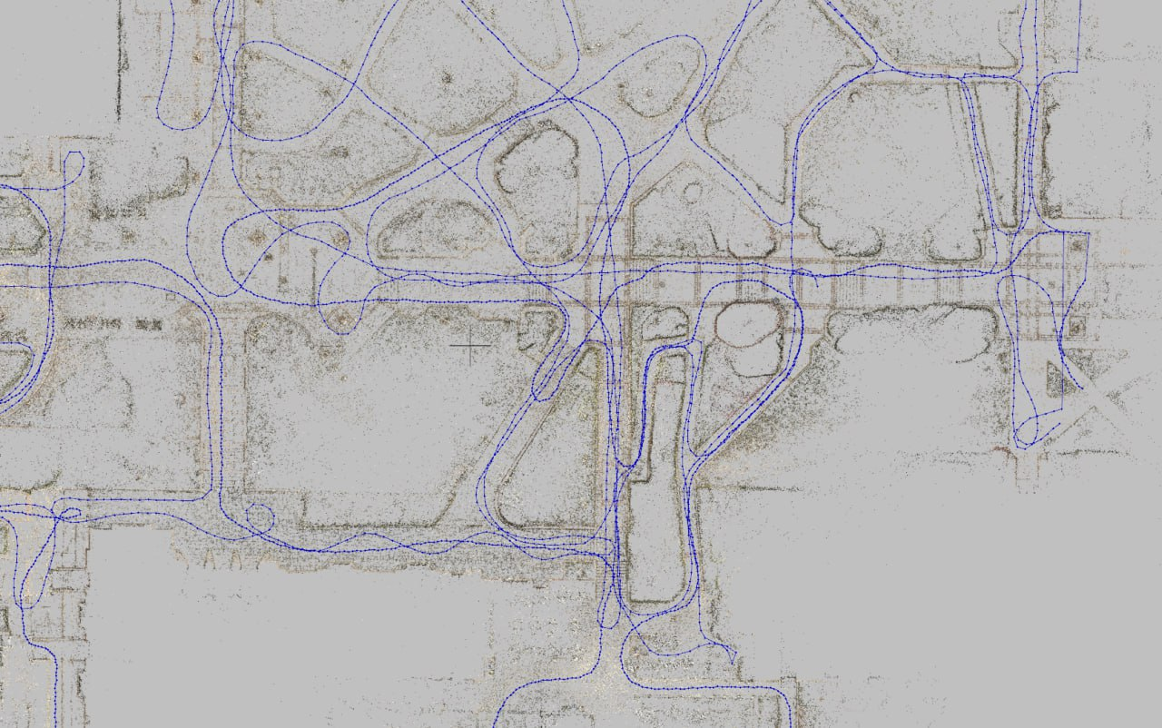
Processing and Alignment: Captured data was uploaded automatically to GeoCam’s Cloud platform. GNSS post-processing refined trajectories, while visual positioning techniques filled gaps in shaded or obstructed areas. The resulting dataset achieved 10 cm 2D positional accuracy, covering every pedestrian surface with spatial continuity.
Data Production and QA: Using GeoCam Desktop and Esri’s ArcGIS Online, the team digitized sidewalk edges, ramps, stairs, and benches following strict production rules set by the UCLA team. QA dashboards tracked coverage, accuracy, and classification, while every feature was visually validated against the imagery, ensuring auditability and reliability.
The Results
The project delivered a suite of powerful outputs:
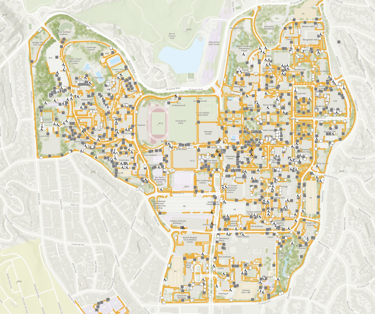
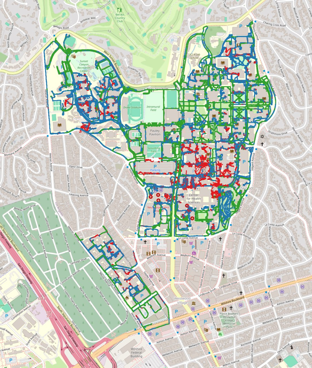
ArcGIS feature services with polygons for sidewalks, ramps, and stairs.
Classified orthomosaics (under the tree canopies) for visual reference of sidewalks, vegetation, and buildings.
3D meshes of complex areas like plazas and stairs.
GeoCam Viewer access for immersive, browser-based 360 degree Imagery access for inspection of features and further analysis.
Comprehensive QA documentation for tracking edits and production rules.
The result has been transformative. UCLA has effectively replaced a legacy line map with polygonal, ADA-ready features, achieving campus-wide consistency at sub-10 cm accuracy. Every ramp, stair, and plaza has been mapped with clear attribution, enabling remote collaboration and QA between UCLA and GeoCam teams. The dataset also established a digital twin foundation, ready to be used for future University transportation and security planning, including the LA28 Summer Olympics.
The Impact
Beyond accessibility mapping, the project demonstrated how GeoCam technology can scale within complex environments. For LA28, it provides a model for high-accuracy, venue-scale pedestrian mapping. For ADA compliance, it offers measurable, visually verifiable documentation for audits. For security and operations, it supplies essential line-of-sight and access data to support crowd management and emergency planning.
Most importantly, the workflow is replicable and any campus, venue, or city district can now benefit from rapid, affordable, and consistent high-accuracy mapping. The UCLA Sidewalks & ADA Mapping Project is a perfect case study that illustrates how imagery-driven GIS can modernize infrastructure planning, accessibility, and operational readiness.