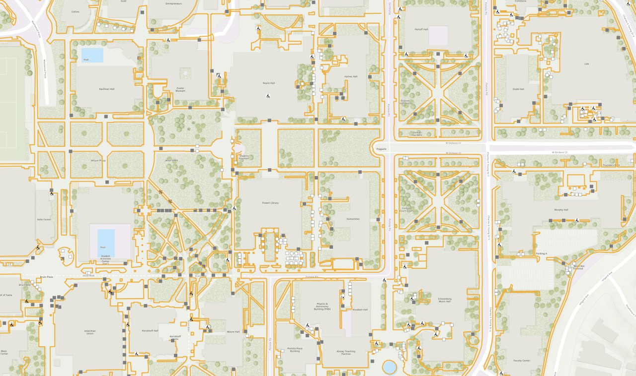
GeoCam and UCLA Transforms Campus Accessibility Mapping with Data
GeoCam delivers a complete, imagery-verified dataset of UCLA’s campus infrastructure.
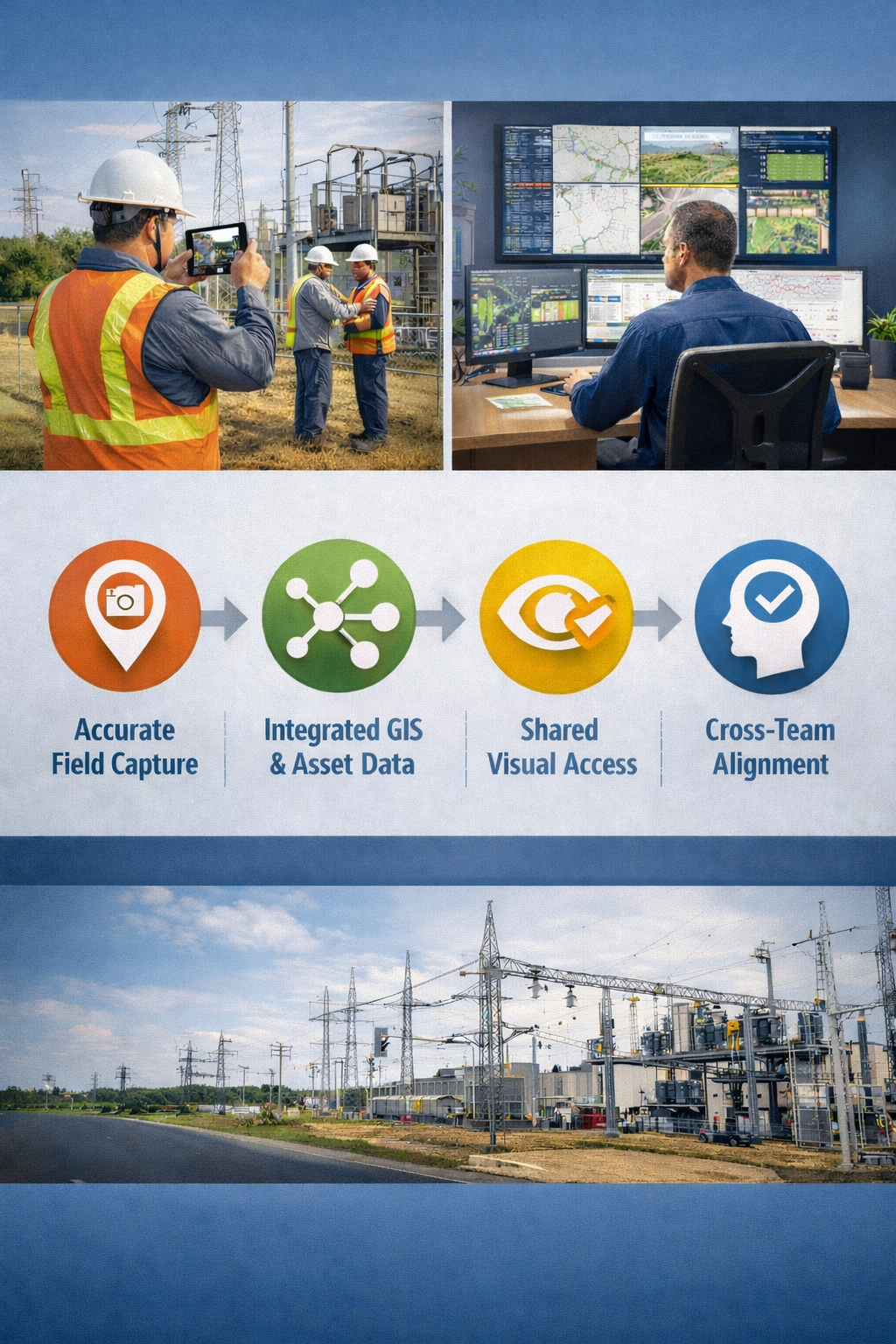
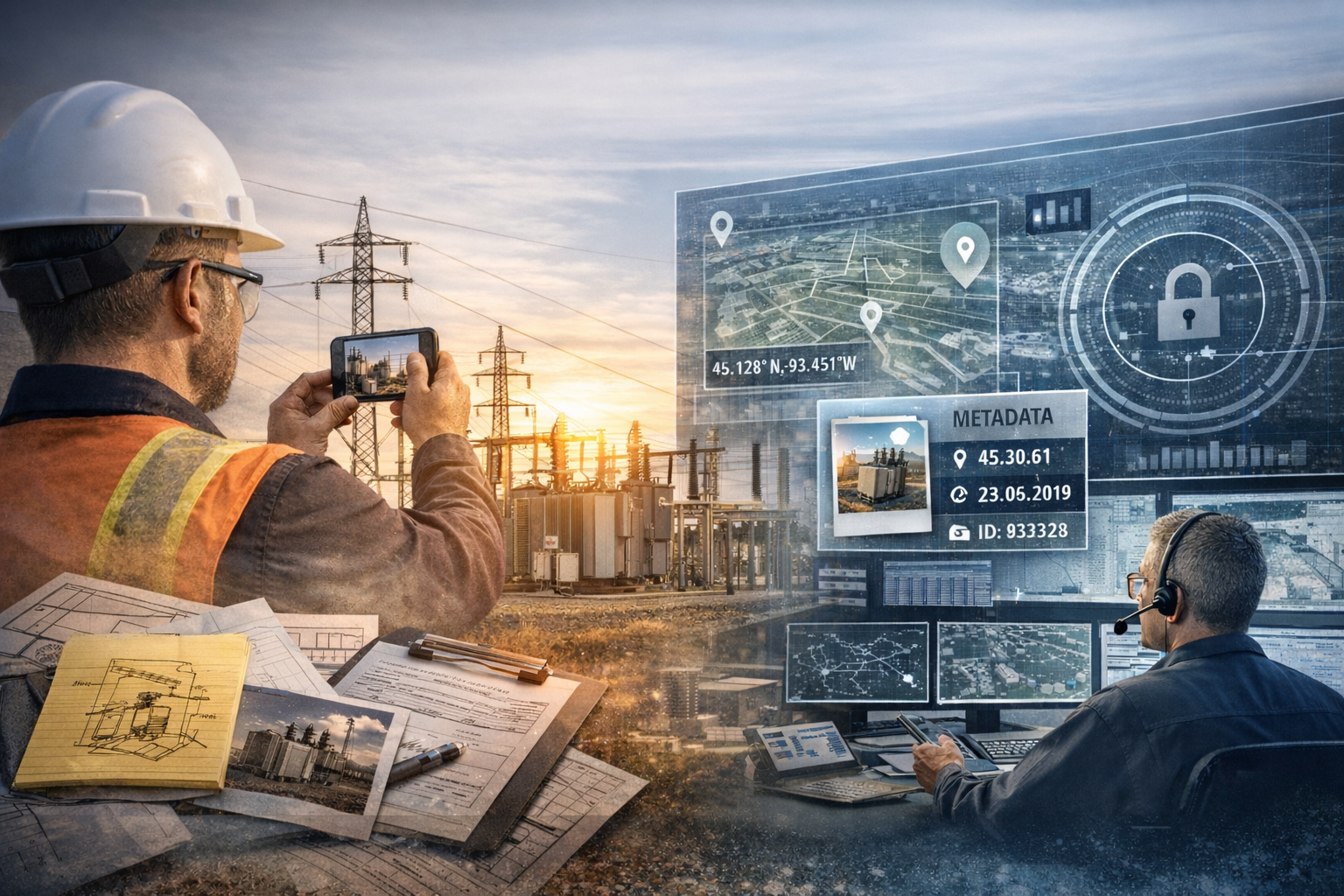
Why Utilities Are Rethinking How They Capture, Trust, and Operationalize Field Data
Across the utility sector, a quiet reckoning is underway.

Why and How GeoCam’s Data Workflow Changes Everything
How a unified field-to-cloud workflow unlocks accuracy, speed, and cost savings

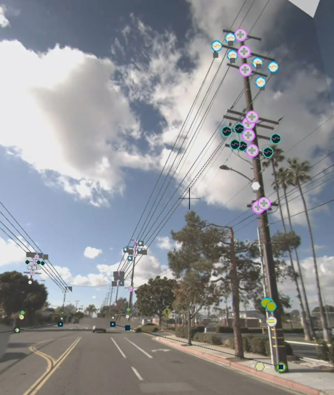
GeoCam Launches New Solution to Transform Utility Substation Maintenance and Management
Image-Based 3D Reality Capture Empowers Utilities to Document, Model and Manage Substations Faster and Smarter

GeoCam Becomes a Member of the NVIDIA Inception Program
Collaboration Will Enable GeoCam to Accelerate the Development of AI-Powered Reality Capture and Geospatial Intelligence

GeoCam Now Supports Enterprise Single Sign-On (SSO)
Seamless SSO means faster onboarding, fewer passwords, and tighter security for your GeoCam data.

GeoCam launches new fiber network fielding solution, starting at $0.01 / network foot for feasibility imagery through $0.12 / network foot for full permitting data
From feasibility to final verification, new GeoCam solution streamlines fiber deployments at scale

From Street to Indoors, at Scale: GeoCam Now Supports ArcGIS Oriented Imagery
Seamlessly connect GeoCam’s immersive 360° imagery with your ArcGIS maps—indoors, outdoors, and at enterprise scale.

The GeoCam Subscription: Big ROI at Your Budget
GeoCam makes powerful reality capture simple, scalable, and affordable

GeoCam and Cal Poly Partner to Democratize Urban Tree Mapping with AI-Driven Reality Capture Technology
Open, AI-powered urban tree mapping system makes critical environmental data accessible and affordable for cities of all sizes, promoting equitable urban forestry and smarter city planning
Advancing Utility Network Management with GeoCam's AI-Driven Reality Capture Platform
How GeoCam’s advanced reality capture platform enables utilities to maintain accurate, current data models, ultimately enhancing service delivery and operational resilience
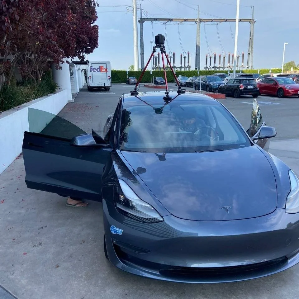
The GeoCam 360 Camera: Transforming Reality Capture
The GeoCam 360 Camera, driving detailed and efficient reality capture across indoor and outdoor environments.

GeoCam’s ‘Public Works: Street Assets’ Data Model Available Now!
Simplifying and streamlining the complicated process of gathering and analyzing street data

Protecting Privacy With Advanced PII-Filtering Machine Learning Technology
GeoCam’s PII-filtering technology uses a 1-billion parameter machine learning model to blur sensitive objects like people and vehicles directly on cameras or during server-side processing, empowering industries to handle geospatial data responsibly.

GeoCam and RINA: Enhancing Infrastructure Management with Advanced AI-Driven Technology
Over 50,000 guardrail terminals were documented statewide with 3D imagery by RINA using GeoCam’s AI-Native Reality Capture Platform

WEBINAR II: Transforming Network Planning with GeoCam & GeoSolv
Recently Myles Sutherland and John Schroeder, CEO of Geosolv LLC, collaborated on a webinar that provides a detailed overview of best practices to deploy Reality Capture technology to help scale and improve the accuracy of Fiber Network Planning. Geosolv serves a diverse clientele, including urban developers and rural broadband providers.

WEBINAR I: GeoCam Street Level Imagery and Mapping
Join GeoCam CEO Myles Sutherland for an in-depth introduction to the capabilities of GeoCam’s AI-Native Reality Capture Platform. Starting with High Accuracy Street Level Mapping, 10cm XY accuracy at any scale, across complex urban, suburban, or rural environments.

GEOCAM UNVEILS AI-NATIVE IMAGING AND MAPPING PLATFORM
GeoCam, on a mission to simplify the way the world documents, analyzes and manages our shared infrastructure, today announced a new subscription service which enables users around the world to operate the GeoCam platform on their own. The GeoCam Reality Capture Platform is an AI-Native, 3D mapping solution that operates across a variety of environments (indoors and outdoors) and modalities (person mounted and vehicle mounted) was that was designed to be simple, scalable and flexible for any user.