GeoCam Launches New Solution to Transform Utility Substation Maintenance and Management
October 22, 2025 – GeoCam today announced a new solution designed specifically for the complex and evolving needs of electric and gas utilities to maintain and manage complicated substation environments. Built on GeoCam’s proven AI-native reality capture platform, this new offering enables utilities to rapidly capture, digitize, visualize, and manage substation environments with unprecedented speed, accuracy, and scalability.
“Substations are among the most critical and complex assets in any utility network, they connect systems, transform voltage, and often span the boundaries between operational zones and even national jurisdictions,” said Myles Sutherland, CEO, GeoCam. “For too long, data collection in these environments has been fragmented, relying on manual surveys and repeated fieldwork. As utilities face rising regulatory and operational pressures, the need for accurate, up-to-date substation data has never been greater. Our new solution delivers a modern, scalable alternative, replacing costly, repetitive surveys with fast, imagery-based intelligence that helps utilities work smarter and safer.”
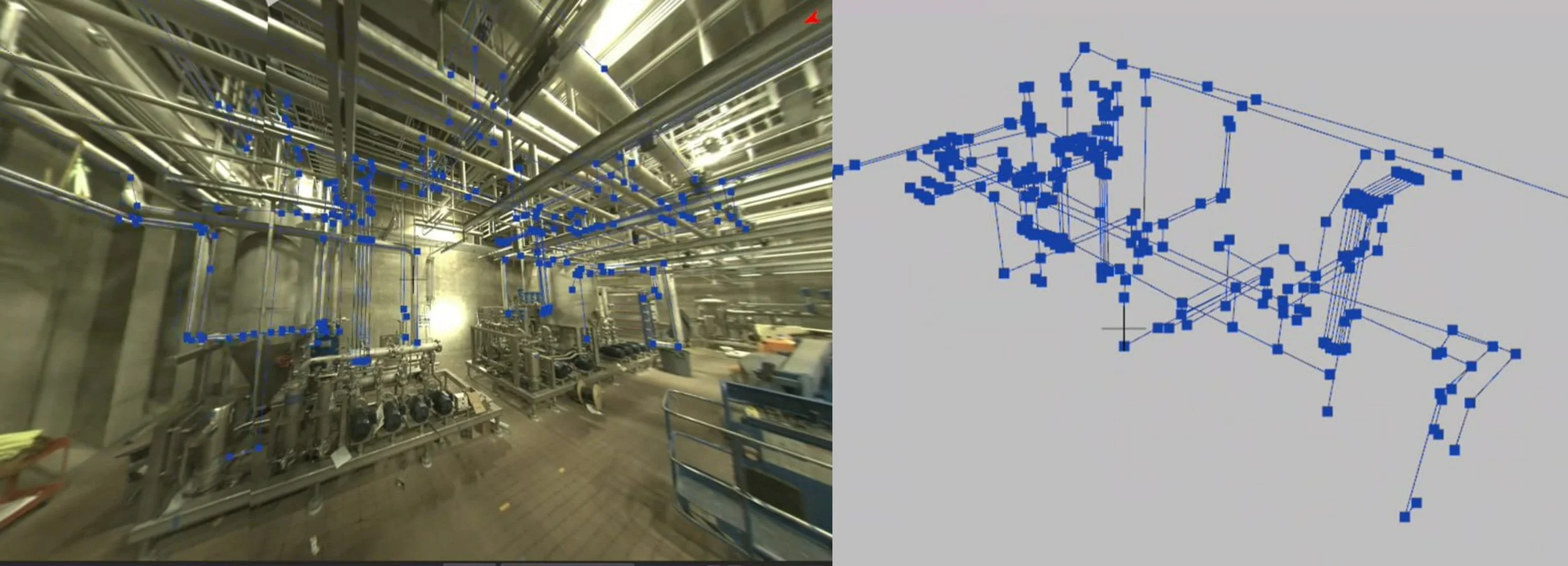
GeoCam’s AI-native Reality Capture Platform transforms ordinary photos into georeferenced, measurable 3D data. Using the lightweight GNSS + ML-enabled GeoCam 360° camera, utilities can capture both indoor and outdoor substation environments in minutes, without bulky and expensive LiDAR rigs or specialized crews. GeoCam’s platform captures images continuously, without speed or stabilization limits, allowing a single person to document an entire substation by walking and/or driving through it.
At the core of the new Substation Solution are four key deliverables that will enable utilities to manage their substations with clarity and precision:
Remote Imagery in Private Web Maps – Utilizing a secure, internal “Street View” for your substation network. Teams can log in from anywhere to explore high-resolution panoramic imagery, visually inspect assets, and review site conditions, with no field visit required.
Integrated 3D GIS Utility Models - Create detailed 3D GIS features into Utility Models directly from GeoCam Imagery and integrate seamlessly with leading systems such as Esri’s Utility Network platform. Delivered in flexible GIS or CAD formats, it supports capital planning, design, and compliance workflows across departments.
Customizable 3D CAD Models (LOD 200–500) - Utilities can select the level of detail that fits their project—from basic visualization (LOD 200) to engineering-grade modeling (LOD 500). GeoCam can produce models that capture every asset visible in imagery, including transformers, conduits, and valves, giving teams the right data at the right level of precision.
Desktop Measurement and Takeoff Tools - Users can calculate distances, heights, and clearances directly within imagery, achieving sub-centimeter accuracy. Engineers and planners can make design and maintenance decisions instantly, without dispatching crews or conducting manual measurements.
A Business Model That Scales with Utility Needs
“We wanted to create a pricing and deployment model that fits the way utilities actually work,” said Sutherland. “You can start with a single substation and scale to an entire network, without needing to change tools, workflows, or contracts.”
GeoCam’s flexible business model ensures that utilities can start small and expand seamlessly. The Substation Jump Start Package, priced at $15,000, offers a low-risk entry point that includes:
One-month camera lease
75,000 sq. ft. of image processing
20,000 sq. ft. of 3D GIS feature extraction into a defined data model (ie: Esri Utility Network, etc.)
Remote training and 10 hours of project support
As utilities grow their deployment, additional compute “credits” can be purchased to scale capacity without re-scoping contracts. Custom Enterprise options also can allow for unlimited processing, supporting flexible organization-wide rollouts with predictable costs.
About GeoCam
GeoCam provides advanced reality capture solutions that transform how organizations capture, analyze, and use spatial data. By combining innovative imaging technology with intelligent software, GeoCam enables businesses to make faster, more informed decisions while reducing the complexity and cost of traditional reality capture methods. For more information, visit www.geocam.xyz
###