Why Utilities Are Rethinking How They Capture, Trust, and Operationalize Field Data
For decades, infrastructure documentation and tracking have been treated as a necessary byproduct of field work, photos taken for reference, sketches saved in project folders, inspection notes scattered across disparate systems... It worked well enough when assets were simpler, projects were slower, and institutional knowledge lived in the heads of long-tenured staff.
But that world no longer exists.
Today’s utilities are managing aging infrastructure, accelerating capital programs, workforce turnover, and rising expectations around safety, reliability, and transparency. In that environment, incomplete or untrusted field data isn’t just inconvenient, it’s expensive, risky, and increasingly untenable.
The Hidden Cost of “Good Enough” Field Documentation
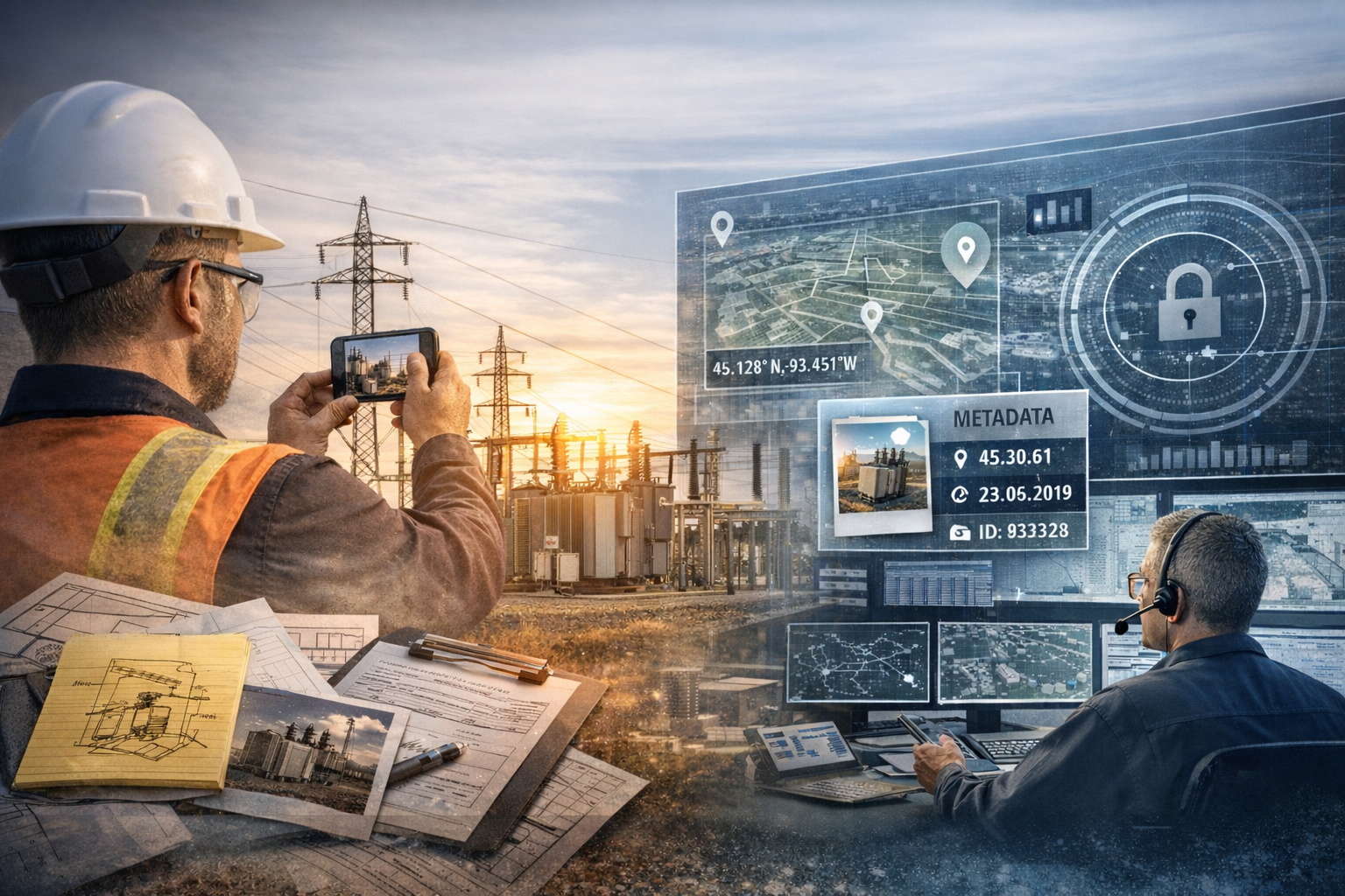
Most utilities already collect a large volume of field data. The issue isn’t quantity. It’s usability.
Field imagery is often:
Captured inconsistently across crews and contractors
Stored without context, location accuracy, or standardization
Difficult to share across engineering, operations, GIS, and compliance teams
Nearly impossible to reuse months or years later when decisions matter most
Utilities working with mobile reality capture platforms often describe the same early realization: they already had photos, but not confidence in what those photos represented or how they could be used later. Without consistent location, orientation, and metadata, images become reference material at best, not decision-ready data.
The result is familiar: return site visits, duplicated inspections, design rework, and avoidable delays. These inefficiencies rarely show up as a single line item, but over time they quietly erode budgets and slow decision-making across the organization.
From Field Photos to Infrastructure Intelligence
Leading utilities are beginning to shift how they think about field data altogether.
Instead of asking, “Did we capture photos?” the better question is: “Can this data be trusted, shared, and used again, without sending someone back into the field?”
This shift reframes reality capture not as documentation, but as infrastructure intelligence:
A durable record of assets and facilities
A shared visual reference across teams
A foundation for planning, design, inspection, and compliance
In practice, this often means moving away from ad hoc photo capture and toward structured, repeatable workflows. For example, some utilities use mobile capture to create consistent, location-aware visual records of substations, distribution assets, or rights-of-way, data that engineering and GIS teams can access long after the field crew has left the site.
Why Mobile Reality Capture Is Gaining Momentum
The turning point for many utilities has been mobility. Modern reality capture platforms allow field teams to document complex facilities and assets as they move through them quickly, safely, and without disrupting work. When paired with GPS, metadata, and standardized workflows, this approach produces data that is:
Easy for crews to collect
Trusted by engineers and planners
Accessible to GIS and asset management teams
Reusable long after the initial visit
Utilities adopting mobile capture tools often point to a simple but meaningful change: engineers and planners can review site conditions remotely with far more confidence, reducing the need for repeat visits and enabling faster design and review cycles.
Just as importantly, mobile capture meets utilities where work actually happens in substations, right-of-way, underground vaults, and remote facilities, not in controlled office environments.
What Utilities Should Expect from Field Data
As expectations rise, utilities are becoming more discerning about the tools they adopt. Increasingly, they’re looking for solutions that deliver:
Consistency: Standardized capture across crews, regions, and contractors
Context: Location-aware imagery tied to real assets and facilities
Interoperability: Data that integrates with GIS, asset management, and planning systems
Longevity: Records that remain useful years after capture, not weeks
Field-first design: Tools that respect the realities of utility work
Reality capture platforms have gained traction in part because they sit at the intersection of these needs, supporting field crews without adding complexity, while producing data that downstream teams can actually rely on.
A New Baseline for Utility Decision-Making
As utilities plan for the years ahead, modernizing infrastructure, adapting to workforce change, and responding to increasing regulatory and public scrutiny, the ability to see, trust, and share field conditions becomes foundational.
The organizations making progress aren’t necessarily collecting more data. They’re collecting better data, once, and using it many times. The shift from fragmented documentation to shared visual truth is reshaping how utilities plan, build, maintain, and explain the systems their communities rely on every day.
GeoCam will be at DistribuTECH 2026, continuing conversations with utilities about how trusted, accessible visual data can support workforce transition, GIS integration, and smarter infrastructure decisions.